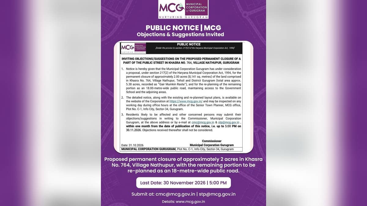
GURUGRAM: Municipal Corporation Gurugram published a consultation notice on Monday, November 2, 2026, inviting objections to a proposal to permanently close about two acres of public-street land in Nathupur. The proposal concerns Khasra No. 764 near Siris Road and DLF City Phase III, with an 18-metre-wide road corridor to preserve access to the government school and adjoining areas.
Residents and other affected people have until 5 pm IST on November 30 to submit written objections or suggestions. The signed notice is dated October 31. Its publication opens a public consultation; the document expressly says it is neither a permanent closure order nor approval to change the land's existing revenue classification.
Which land is covered
The official notice and attached plans describe Khasra No. 764 as an approximately 5.38-acre parcel recorded in the corporation's ownership in the 2020-21 revenue record. Its recorded use is Gair Mumkin Rasta, or public passage land. The existing Siris Road runs through the elongated, irregular parcel, which has a built-up portion on its western side.
The change under consideration concerns an eastern pocket measuring about 3.44 acres. That pocket adjoins DLF City Phase III and extends towards the government school and Nathupur's hilly area. Within it, the proposed public-road corridor would occupy approximately 1.44 acres, leaving about two acres outside the corridor for proposed closure as public street.
- Total khasra area: approximately 5.38 acres.
- Eastern pocket under consideration: approximately 3.44 acres.
- Retained road corridor: 18 metres wide, covering approximately 1.44 acres.
- Public response deadline: November 30, 2026, at 5 pm IST.
The figures are approximate and subject to verification and actual demarcation by the competent revenue authorities. The notice says the rest of the khasra outside the eastern pocket, including the existing Siris Road and built-up area, is outside the proposed closure. Residents should use the attached plans to identify the precise boundaries and alignment.
MCG says the land proposed for closure would remain in municipal ownership and is intended for municipal or public purposes. The document states that no part is proposed for transfer to a private party. The stated purpose is to replace an irregular public-street layout with an aligned road corridor while preserving lawful connectivity.
How to inspect plans and submit a response
The existing survey plan and proposed layout are available for free inspection on working days during office hours at the Senior Town Planner's office, MCG, Plot No. C-1, Info City, Sector 34. The existing plan identifies boundaries, Siris Road and surrounding features; the proposed plan identifies the road corridor and the portion proposed for closure.
Representations should be addressed to the Commissioner. They can be delivered by hand against a receipt, sent by registered or speed post to that address, or emailed to cmc@mcg.gov.in and stp@mcg.gov.in. The notice asks for the subject or envelope to identify objections or suggestions under section 217(2), Khasra No. 764, Village Nathupur.
Each response should give the person's name, address and contact number, explain the right or interest claimed or how the person is likely to be affected, and set out the grounds with supporting documents where available. The opening notice fixes November 30 at 5 pm IST as the deadline and says late submissions will not be considered.
What happens after consultation
The corporation will consider the proposal alongside public responses and the relevant branches' comments and recommendations. It may approve, modify or decline the sanction under section 217(2) of the Haryana Municipal Corporation Act, 1994. Any later treatment of closed land, its public use and revenue-record changes would proceed separately under applicable law.
The House resolution and circulation record
The detailed notice traces the proposal to Agenda No. 2 at the Corporation House meeting held on September 11, 2026. It identifies section 216 as the provision under which the public street is vested in the corporation, and refers to section 217(1) and sections 219 and 220 for the proposed road replanning.
The survey records the total khasra at approximately 21,780.17 square metres. Its proposed road corridor is approximately 5,842.67 square metres, and the closure portion is listed at 8,141 square metres. The circulation list includes the Deputy Commissioner-cum-District Collector, MCG's Chief Town Planner and the Joint Commissioner of Zone IV, whose office is to display the notice. The IT Branch is assigned to upload the notice and enclosures.
Other local infrastructure coverage includes the pedestrian crossing review, footpath repair targets and municipal land clearance near Dhani Chowk. Those are separate projects; the Nathupur consultation must be assessed against its own notice and plans.