The remnant of Cyclone Arnab weakened into a depression over south Chhattisgarh and adjoining south Odisha on Thursday morning, the India Meteorological Department confirmed. The reduced intensity does not remove rainfall warnings across eastern India and Uttar Pradesh. IMD's new morning update replaces the earlier overnight assessment that classified the system as a deep depression.
The cyclone advisory issued at 09:00 IST on October 29 places the system at 19.0 degrees north and 81.9 degrees east at 05:30 IST, about 20 kilometres west of Jagdalpur in Chhattisgarh. It had moved nearly northwards at 22 kilometres per hour during the previous six hours. Those coordinates describe the morning observation, not a later live position.
IMD expects the depression to continue nearly northwards and weaken into a well-marked low-pressure area around 17:30 IST on Thursday. That evening stage remains a forecast, not a development already confirmed. The advisory says radar stations at Raipur and Sambalpur are monitoring the system as it moves inland.
Coastal warnings continue as the system weakens
The Visakhapatnam coastal bulletin issued at 03:55 IST remains valid until 14:30 IST on October 29. Its earlier storm-position description has been superseded by the morning cyclone advisory, but its separate marine forecast describes rough to very rough seas along both the north and south Andhra coasts. It is not an announcement that coastal conditions have returned to normal.
It also lists widespread rain or thundershowers with isolated heavy falls along the north Andhra coast. Readers should therefore distinguish the reduction in the storm's classification from the separate coastal weather warning, rather than treating the former as a declaration that conditions are normal.
Port signals also reflect the reduced coastal threat without removing all caution. The coastal bulletin replaces the earlier danger signals at Kakinada, Visakhapatnam and Gangavaram with local cautionary signal III. It keeps that cautionary signal at Kalingapatnam and Bheemunipatnam. The same document still warns of very poor visibility during rain or thundershowers along the north Andhra coast.
The national cyclone bulletin issued at 10:00 IST on October 29 forecasts isolated heavy rain over north coastal Andhra Pradesh and interior Odisha on Thursday. North Chhattisgarh is covered by a heavy to very heavy rain forecast at a few places. Jharkhand has a similar intensity warning at isolated places.
For Bihar, the new bulletin forecasts light to moderate rain at many places, with heavy to very heavy rain at isolated places on October 29 and 30. These warnings concern rainfall after the cyclone's landfall, not a prediction that the storm will remain at its earlier coastal intensity throughout the affected region.
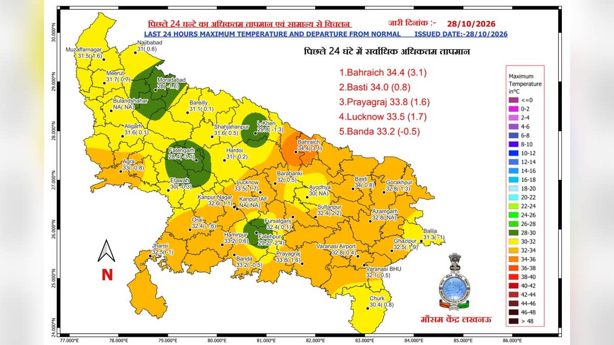
East Uttar Pradesh's Thursday forecast includes light to moderate rain at most places and isolated heavy to very heavy rain. The bulletin carries a further rainfall warning for northeast Uttar Pradesh on Friday, October 30, followed by isolated heavy rain on October 31. A regional warning does not mean every district or neighbourhood will receive the same rainfall.
Varanasi's Friday forecast is lighter than the regional warning
The more local Lucknow district bulletin issued at 12:30 IST on October 28 gives Varanasi a different Friday picture. It lists moderate rain with very heavy spells at most places for Thursday, followed by very light to light rain at isolated places on Friday, October 30. Saturday also has an isolated light-rain forecast, before a dry entry for Sunday.
The district outlook was covered in Dalimss News's report on the revised Varanasi forecast. Thursday's confirmation of further weakening adds a new development inland; it does not turn the existing Friday forecast for Varanasi into a new heavy-rain warning.
Each district forecast day runs from 08:30 IST until 08:30 the next morning. Thursday's higher-risk window therefore extends into early Friday. The lighter Friday entry starts at 08:30 IST on October 30, a distinction worth checking before planning an early-morning departure.
IMD Lucknow's separate October 28 press bulletin names Varanasi in Thursday's heavy to very heavy rain warning. Friday's corresponding list instead includes districts such as Gorakhpur, Basti, Kushinagar and Maharajganj. Varanasi is not named in that Friday list. The broader east-UP warning must not be substituted for the district entry.
The same advisory identifies possible waterlogging, reduced visibility and interruptions to local services during heavy rain. It advises avoiding submerged routes and overflowing bridges, and taking shelter in a secure building during thunderstorms rather than under a tree. Those are precautionary instructions, not confirmation that flooding or damage has occurred.
Travel notices require their own date checks. Our earlier report on the ministry's Varanasi flight cancellation list concerns an October 27 statement, not a fresh confirmation of Thursday's operations. A weather bulletin cannot establish whether a particular train or flight is running. No train cancellation numbers are included here without a verified current railway notice.