
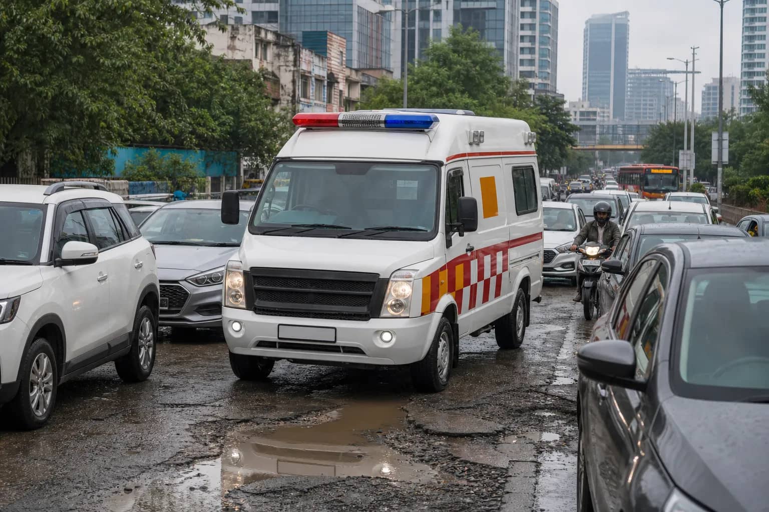
GURUGRAM: An ambulance took about 30 minutes to cover four kilometres to a housing society off Golf Course Extension Road last month. Doctors and drivers say that kind of delay is no longer exceptional in Gurugram: congestion, potholes, waterlogging and blocked approaches can double a journey precisely when a patient has the least time to spare.
The concern is sharper because emergency benchmarks are measured in minutes. National ambulance guidelines recommend a response of about ten minutes in busy urban areas and aim for patients to reach the nearest appropriate medical facility within 20 minutes. On national highways, the road authority's incident-response contracts use a ten-minute target for ambulances covering events within a ten-kilometre radius after a ticket is accepted.
The distance on a map is not the journey
Emergency physicians in the city say the obstacle is rarely straight-line distance. A short route can include a damaged sector road, a waterlogged underpass, a queue at a signal and a society gate where the driver has not been given the correct tower or entry point. Old Gurugram adds narrow lanes and broken surfaces that force an ambulance to slow down to avoid worsening a patient's pain or destabilising equipment.
Drivers have described potholes that make the vehicle shake continuously, a serious issue when carrying someone with a spinal injury, fracture or active bleeding. Congestion creates a second problem: motorists may want to make way but have nowhere to move because lanes are packed or roadside parking has narrowed the carriageway. Sirens cannot create physical space.
Hospitals can improve dispatch, but they do not control the full route. A central system should distinguish three intervals: call receipt to dispatch, dispatch to patient and patient to hospital. Without that split, every delay is blamed on traffic even when a vehicle was unavailable or the pickup information was incomplete. Gurugram does not currently publish a consolidated public dashboard covering government, highway and private ambulance performance.
A citywide response map would expose recurring traps
Each delayed trip should generate a route record showing where time was lost. Repeated slow points can then be sent to the responsible agency: traffic police for signal clearance, MCG or GMDA for road repair, NHAI for highway access and housing societies for gate protocols. The same data would show whether ten-minute targets are realistic by zone and time of day.
Housing complexes have a role too. Security desks should maintain an emergency entry procedure, keep internal lanes clear and send a guard to guide the vehicle when a call is placed. Families should share the tower, gate and a live contact number rather than only a postal address. These steps cannot repair a city road, but they can prevent the last 500 metres from becoming another delay.
For Gurugram's administration, ambulance movement should be treated as a road-performance test. If an emergency vehicle cannot travel four kilometres within a reasonable window, the failure is not confined to health care. It reflects traffic management, maintenance and urban design at once. Publishing response times would make that shared responsibility visible and give the city a measurable target: protect the first ten minutes instead of explaining where they went.