GMDA Says Gurugram Waterlogging Hotspots Have Fallen From 90 to Seven
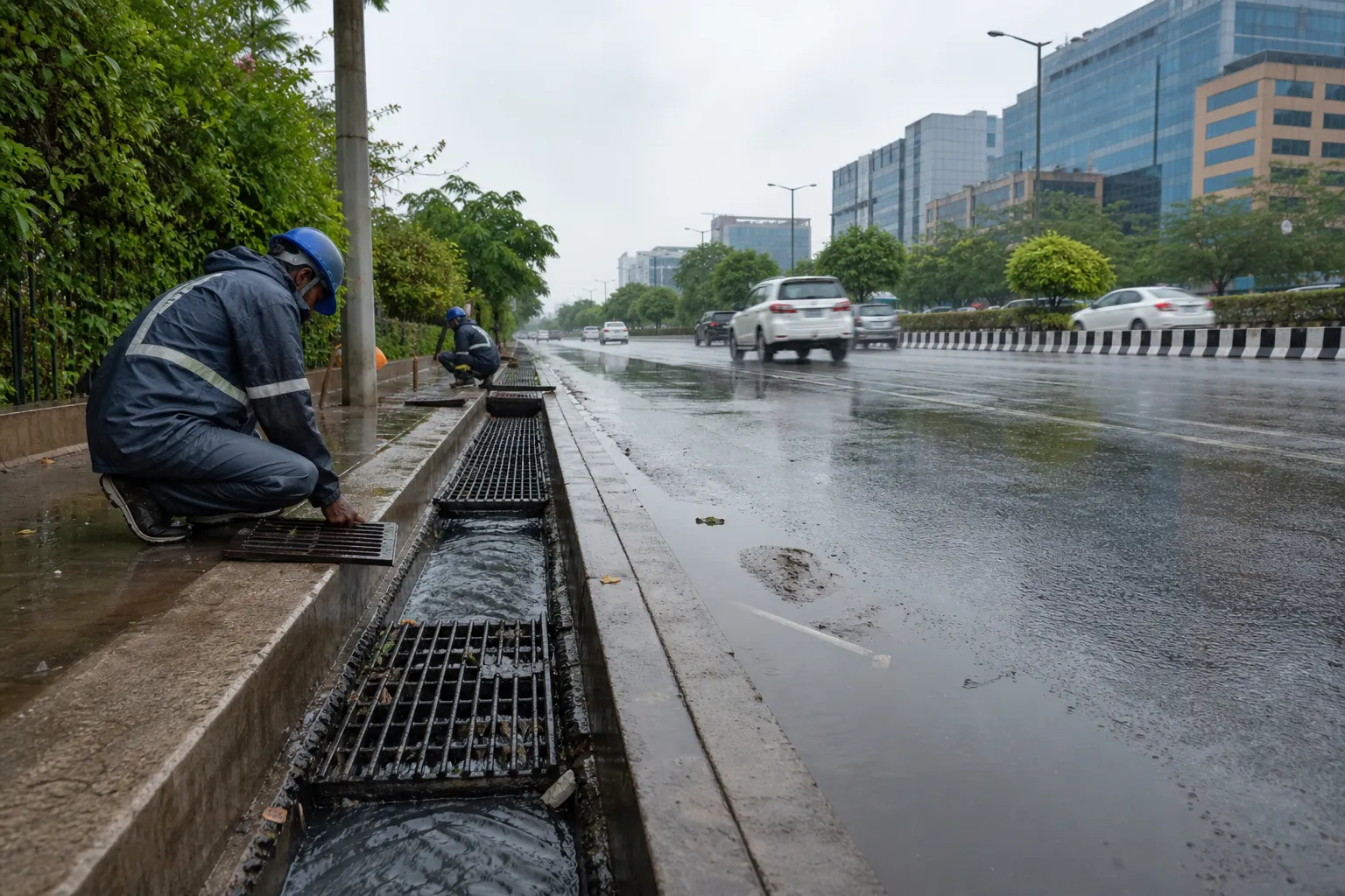
GURUGRAM: The Gurugram Metropolitan Development Authority has claimed that the city's major waterlogging hotspots have reduced from roughly 90 in 2019 to seven during the current monsoon, crediting a multi-year programme of drainage upgrades and engineering interventions.
The number is an official assessment, not a declaration that Gurugram is free of flooding. Rain intensity, the time taken for water to recede and conditions on internal roads can produce a very different experience from one neighbourhood to another. The remaining seven locations, along with smaller local pockets, still require attention.
GMDA has pointed to desilting, better connections between drains, removal of bottlenecks and capacity improvements as reasons for the reduction. Work at junctions and along major corridors is intended to move stormwater into the master-drain network instead of allowing it to pool on carriageways. Coordination with the Municipal Corporation of Gurugram and highway authorities remains necessary where one agency's drain meets another's road.
The Sohna Road corridor continues to present such coordination challenges. Surface levels, service roads, development plots and drainage outlets cross institutional boundaries, so a cleared trunk drain cannot solve waterlogging if the feeder connection is missing or obstructed. Similar gaps can persist in newly built sectors where urban construction has moved faster than the complete stormwater network.
The authority is also piloting green water-harvesting structures with technical support at Sector 31, Sector 39 and near AIT Chowk. These interventions are meant to hold or absorb part of the runoff rather than push every litre immediately into a pipe. Their performance will need to be measured over repeated rain events, particularly when the soil is already saturated.
Residents can reasonably ask how a hotspot is defined. A junction where water clears in under an hour is not the same as a stretch that remains impassable for much of the day, yet both may generate complaints and traffic disruption. Publishing location-wise recession times and rainfall readings would make the seven-site claim easier to evaluate.
This monsoon has already shown that intense spells can still slow traffic and flood internal lanes. Road cave-ins and broken surfaces can worsen the disruption even where water eventually drains. Maintenance, therefore, must cover the full system: grates, feeder lines, master drains, pumping arrangements and the road structure around them.
Reducing a list from 90 to seven would be meaningful progress if the same method and threshold were used across the years. The next step is evidence residents can see: a public map of the remaining sites, response times after rain and a repair schedule. Until then, the figure should be read as GMDA's claim of improvement, not a verdict on every Gurugram street.
Sources and reporting
Based on GMDA's current monsoon hotspot assessment and stated drainage interventions, checked on 1 August 2026.
Related Stories
Mayor Announces Stricter MCG Drive Against Stray Cattle
Court Stays Further Eviction at Baba Balak Nath Temple Complex
HRERA Orders Rs 19.28 Lakh for Delayed Sector 82 Flat Possession

STF Arrests Agra Man With Six Country-Made Pistols in Sohna

FDA and Police Seize Codeine Syrup, Alprazolam in Sohna Raid