
Gurugram Braces for Short, Intense Showers as Rainfall Remains Highly Localised
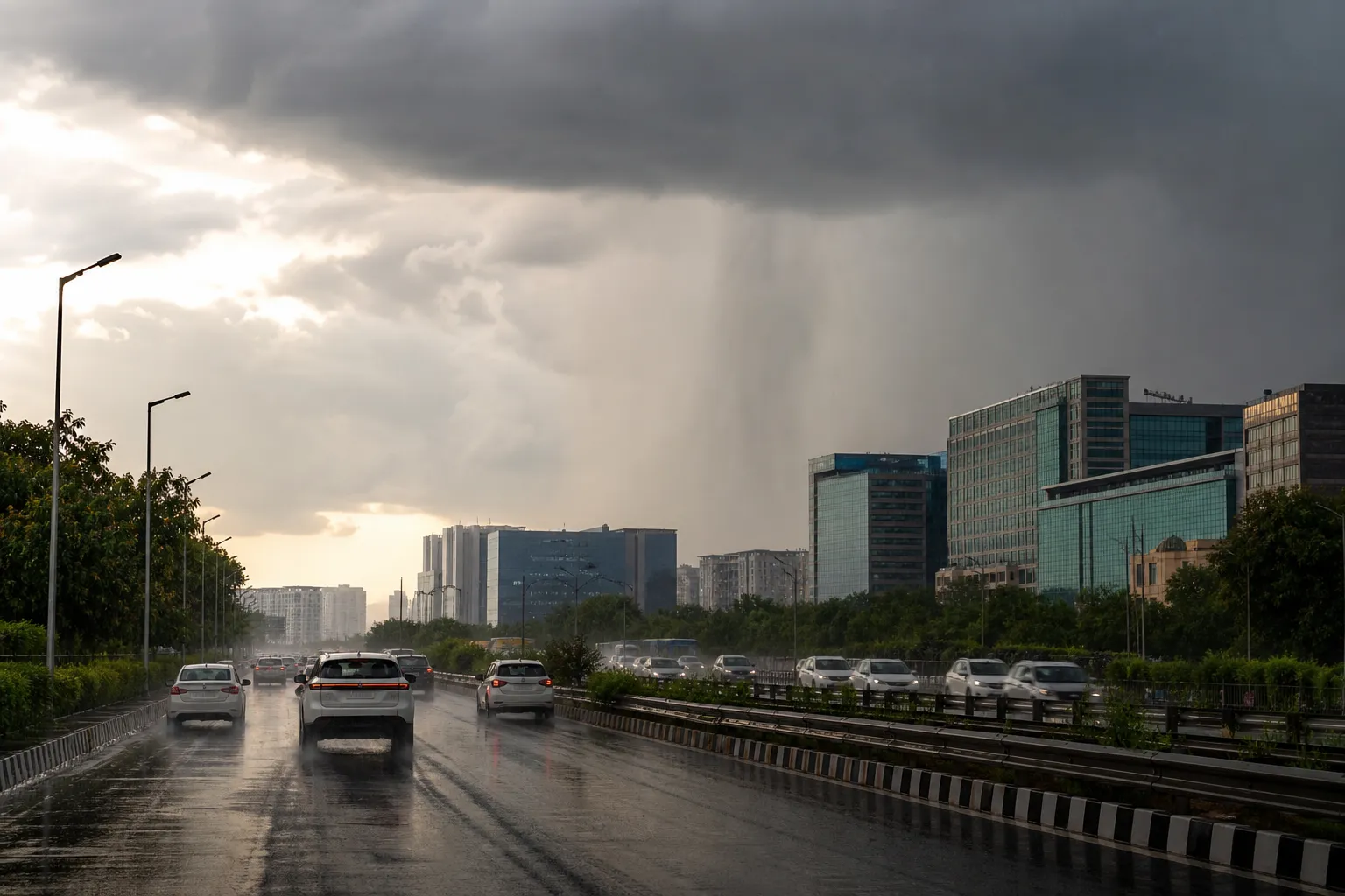
GURUGRAM: Gurugram could see short, intense and sharply localised showers on Friday as the monsoon axis shifts north, but the forecast does not point to uniform rain across the district. Some neighbourhoods may receive a heavy spell while nearby areas remain almost dry.
The uneven pattern was visible on Thursday. Gurugram tehsil recorded 34mm between 8am and 5pm, while Kadipur and Harsaru each received 45mm. Wazirabad recorded 4mm and Badshahpur 1mm; Sohna, Manesar, Pataudi and Farrukhnagar remained dry during the same period.
Heat and humidity set the stage
The KVK weather station recorded a maximum of 35.6 degrees Celsius and a minimum of 27.2 degrees on Thursday. The maximum rose 1.6 degrees from the previous day, while the minimum was 5.2 degrees higher. That warmer, humid air can support rapid thunderstorm development when local conditions align.
Weather guidance for Friday indicates that individual spells could last roughly 20 to 40 minutes and affect only a limited part of the NCR. That means a dry sky at one office complex is not evidence that a warning has failed, just as a flooded junction does not show that the entire district received the same rain.
Forecast is a probability, not a promise
The India Meteorological Department has forecast broad rain activity over Haryana, Chandigarh and Delhi on 14 and 15 August, with another active period expected on 17 August. The possibility of heavy rain over parts of the region remains in the outlook through 19 August.
For Gurugram, the practical risk is intensity over a small drainage catchment. A cloudburst-like spell over one sector can fill an underpass or service lane quickly even when the district average remains modest. Commuters should judge conditions on the route ahead, not only at their starting point.
A wet week, but not every hour
The district averaged 73.5mm in the week from 7 to 13 August against a normal of 41.4mm. Cumulative seasonal rainfall stood near 334mm, about 10 per cent above the normal 304.8mm. Yet the district average for the latest 24-hour reporting window was only 0.1mm, showing how timing and station coverage can produce very different summaries.
Residents should avoid stopping beneath trees during thunderstorms, allow extra braking distance on wet roads and stay out of waterlogged underpasses. Civic teams, meanwhile, need mobile pumps and traffic staff positioned according to live radar and field reports. Friday may not be an all-day washout, but a brief, concentrated shower can still reshape the evening commute in minutes.
Sources and reporting
Based on IMD regional forecasts and Gurugram district rainfall and temperature observations available on 14 August 2026.
Related Stories

Two Held for Alleged Bid to Run Over Men

Retired HSVP Officer Surrenders in SCO Plot Case

Cops Warn Weekend Bikers After Recent Crashes
HT Pole Still Blocks Road Between Sectors 102, 102A

HSVP Plans Single City Office in Sector 16