Varanasi Picks CityFlow and Janjatra to Untangle Old Kashi's Crowd Movement
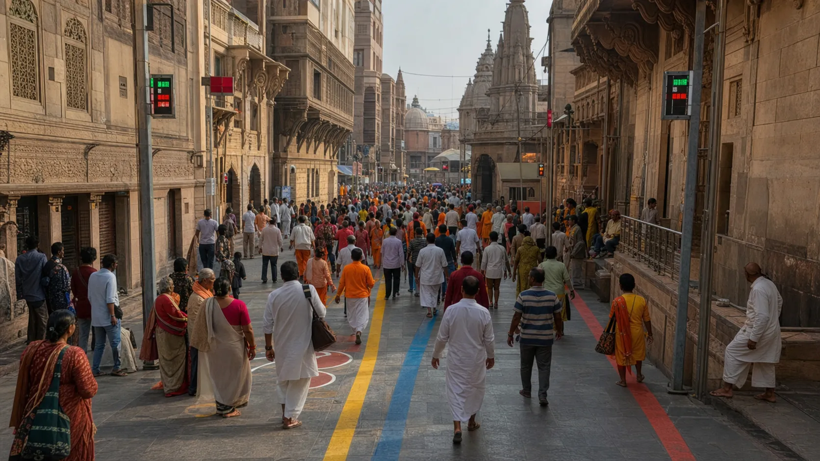
VARANASI — Two very different ideas have been chosen to tackle the same Banarasi problem: how to move pilgrims, residents and visitors through old Kashi's compressed lanes without turning every busy hour into a human traffic jam.
CityFlow, developed by CITYDATA.AI with Nippon Koei, and Janjatra, created by The Urbanizer, are the winners of Varanasi's Sustainable Cities Challenge. The programme was led locally by Varanasi Nagar Nigam with the Toyota Mobility Foundation, Challenge Works and WRI India. Both teams are due to receive financial and advisory support to scale their solutions in the historic core.
CityFlow is the technology-heavy entry. It combines big data, computer vision and generative AI to measure and analyse crowd movement, simulate what may happen next and help authorities intervene at a congestion hotspot. Janjatra works closer to eye level, using colour-coded routes, dynamic digital signs and small tactical changes to help people understand where to walk.
WHY KASHI NEEDS BOTH APPROACHES
A control room may know that pressure is building near a junction, but that information is useful only if someone on the street receives a clear instruction. Similarly, a well-designed sign cannot prevent a dangerous squeeze if officials do not know that two large streams are about to meet. CityFlow and Janjatra make sense as a pair because one reads movement and the other translates direction into the physical city.
Two additional ideas received honourable mentions. Behtarway, developed by VOGIC AI, proposes hyperlocal pedestrian navigation, while Nayichaal from Prameya Consulting focuses on routes for elderly people, persons with disabilities and other users who are often treated as an afterthought in crowded heritage zones.
The challenge drew global attention because Varanasi's crowd problem is unusually complex. The old city cannot simply be widened. Temple queues, homes, markets, schools, deliveries and emergency access share a small amount of space, while festival days can change footfall within minutes.
THE HARD WORK STARTS AFTER THE PRIZE
Selection does not mean the system has already solved congestion. Scaling requires sensor placement, data rules, sign approvals, maintenance and training for the officers who will act on an alert. The city must also explain what its cameras measure, how long data is retained and how individual privacy is protected.
Street trials should be tested with residents and shopkeepers, not placed over their heads. A route that works for a visitor on a demonstration day may fail when a delivery cart blocks the lane or a barricade shifts after rain. Clear Hindi and English information is essential, and icons should work for people who read neither fluently.
The strongest result would be modest and measurable: fewer counterflows, faster dispersal after aarti, clearer access for ambulances and fewer visitors stopping in the middle of a lane to ask for directions. Varanasi does not need technology that merely looks smart on a screen. It needs a system that makes the next crowded walk through Kashi calmer, safer and easier to understand.
Sources and reporting
Based on the 20 and 24 July 2026 announcements by the Sustainable Cities Challenge organisers and Varanasi Nagar Nigam. The solutions have been selected for scaling; citywide results have not yet been demonstrated.
Related Stories
Railways Orders Weekly Puja Special 09465 via Varanasi Through November
Hindi Diwas Marked Across BHU, Sanskrit University and Kashi Vidyapith
Lohta Police Register FIR After Bhitari Villager Alleges Hostage Beating
Baragaon Police Book Named Youths After Kazisaray Tea-Stall Assault and ₹1,900 Loot
Mayor Announces Stricter MCG Drive Against Stray Cattle